
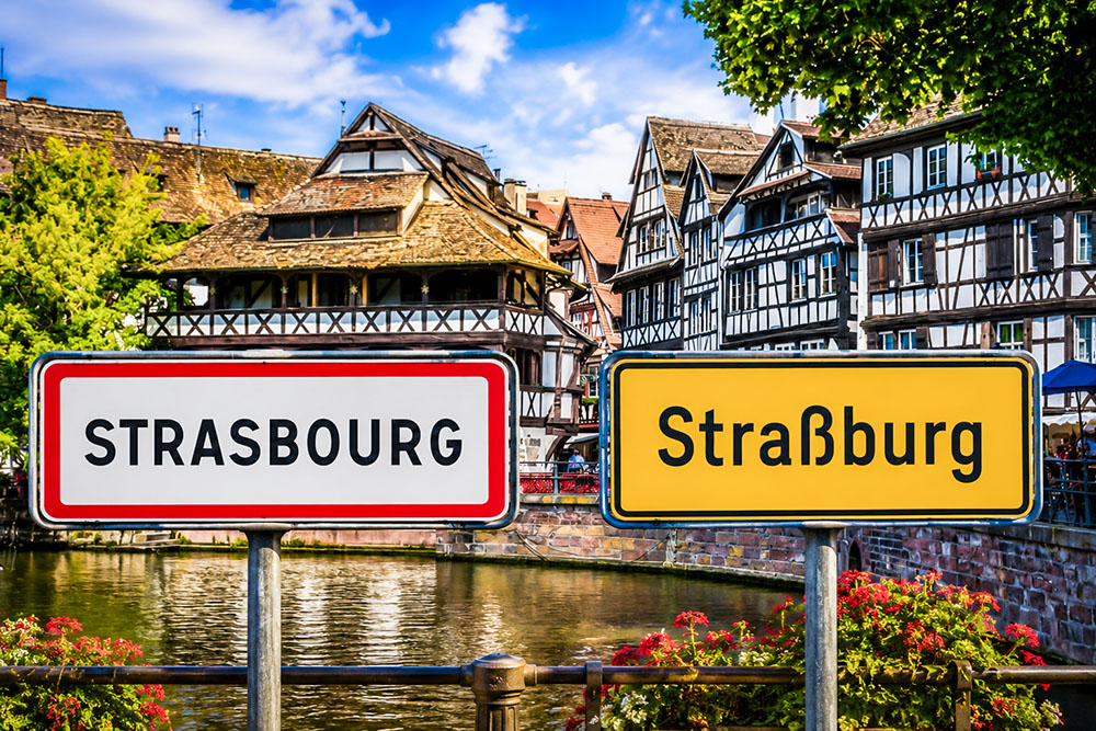

There are many reasons why governments change place names, but politics, identity and power are often part of the story.
That question has suddenly become very current. On 27 August 2026, President Donald Trump signed an executive order giving Lake Ontario a new name for official US federal use: Lake America.
The news caught my attention for a personal reason too. Lake Ontario was one of the first great North American landscapes I encountered on my very first visit to the United States. I still remember seeing that immense stretch of water and, at the time, giving no thought whatsoever to the possibility that its familiar name might one day become politically contested.
The order directs the US Secretary of the Interior and the Board on Geographic Names to update the Geographic Names Information System and federal maps, documents and communications accordingly. Read the White House executive order
It was not Trump’s first such decision. In 2025, the Gulf of Mexico had already become the Gulf of America in US federal terminology.
This time, however, the reaction was particularly striking because Lake Ontario is shared by the United States and Canada. Canadian Prime Minister Mark Carney responded that Canada would continue to call it Lake Ontario. Read Reuters’ report on Canada’s response
A name on a map can seem permanent. Mountains, rivers, towns and villages may keep the same names for centuries, sometimes for far longer than the states that govern them.
But names can also become powerful symbols. When borders move, regimes change or governments want to strengthen a particular national identity, the map itself can become part of the story they want to tell.
And few parts of France illustrate this better than Alsace.
Over the past few centuries, Alsace has moved between French and German rule several times. Strasbourg has been officially Strasbourg and Straßburg. Mulhouse remained officially Mulhausen for decades after joining France. Small villages close to the linguistic border could have both French and German names, while others were deliberately given German names during the First World War.
Under Nazi rule from 1940, the process went much further. Towns and villages were Germanised, French street names disappeared, and even family names and first names could be altered as the authorities attempted to remove visible traces of French influence from Alsace.
But there is an important distinction to make from the start.
Not every change of place name is an act of nationalism.
Strasbourg and Straßburg, for example, are two historical forms of the same name in two different languages. The Germans did not suddenly invent Straßburg when Alsace became part of the German Empire in 1871. The name had been used for centuries — including by German-speaking Alsatians when Strasbourg was still part of France.
Elsewhere, however, governments really did intervene to make the map conform more closely to the political identity they wanted a territory to display.
That difference matters.
So rather than simply listing places that have changed names, I want to look at something more interesting:
Who really owns a place name?
Is it the government that writes it on an official map? The people who live there? The language they speak? Historical tradition? Or can several names remain legitimate at the same time?
To explore those questions, we are going to travel through more than three centuries of Alsatian history — from Louis XIV and the French Revolution to the German Empire, two world wars and Nazi rule.
And eventually, we will come back to Lake Ontario.
Because although the circumstances are very different, the debate surrounding Lake America reminds us of something that people in Alsace have known for a very long time:
changing a name on a map is easy. Changing the history, language and memory attached to that name is something else entirely.
Table of Contents
Why Governments Change Place Names
Governments change place names for several reasons: a change of sovereignty, a change of administrative language, the restoration of an older historical name, linguistic standardisation, or a deliberate attempt to promote a national or political identity. These situations may look similar on a map, but they are historically very different.
Place names change for many reasons.
Sometimes the explanation is fairly innocent. A place may simply have different names in different languages.
Strasbourg in French and Straßburg in German are a good example. Both forms are historical, and neither was invented in the nineteenth century to make a political point.
The same thing happens all over Europe. The city French speakers call Cologne is Köln in German. Florence is Firenze in Italian, while Bâle is Basel in German.
Using one of these names does not necessarily mean that anyone is making a political claim.
But place names can also change because the government has changed.
When sovereignty passes from one state to another, the new administration may begin using the version of a name belonging to its own language. That happened repeatedly in Alsace.
Even this, however, is not necessarily the same thing as deliberately renaming a place.
A place can have more than one legitimate name
Two or more historical names can coexist.
Strasbourg and Straßburg developed within French and German linguistic traditions for the same city.
Depending on the language, historical period and administrative authority, one place could therefore appear under different forms without anyone having created a new name from scratch.
This matters when reading old maps.
If we see Straßburg on a German map from 1900 and Strasbourg on a French map from 1860, it is tempting to assume that Germany invented the German name after annexing Alsace.
It did not.
A change of sovereignty can change the official name
A second situation occurs when political control changes and one of those existing names becomes the official administrative form.
After Alsace became part of the German Empire in 1871, Straßburg replaced Strasbourg in German official usage. Mülhausen replaced Mulhouse, Hagenau replaced Haguenau, and Weißenburg replaced Wissembourg.
In these cases, the German authorities were generally not inventing names.
They were making existing German forms official.
Governments can deliberately nationalise the map
A third situation is more political.
A government may decide that certain names look or sound too foreign for a territory it considers part of the nation.
At that point, the aim is no longer simply to use the state’s administrative language. It is to make the map itself conform more closely to a desired national identity.
This became especially clear in Alsace-Lorraine during the First World War.
By 1915, the territory had belonged to the German Empire for more than forty years, yet several villages — particularly in Romance-speaking areas — still carried visibly French official names.
During the war, the imperial authorities decided to change them.
Sometimes a new name is an ideological statement
The fourth situation is the clearest.
A regime can replace an existing name with another chosen specifically to honour a leader, promote an ideology or symbolise a new political order.
When Strasbourg’s Place Broglie became Adolf-Hitler-Platz under Nazi rule in 1940, nobody could reasonably describe that as a translation.
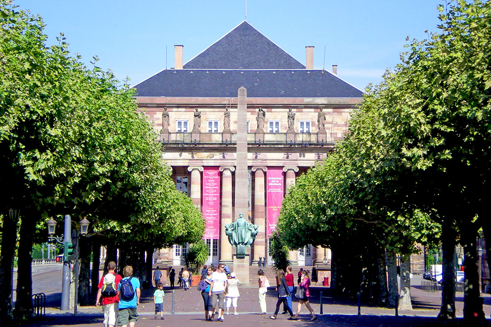
The new name was itself a political message.
So Strasbourg becoming Straßburg, Bellefosse becoming Schöngrund and Place Broglie becoming Adolf-Hitler-Platz may all involve a different name appearing on a map.
Historically, however, they represent three very different processes.
To understand why, we need to go back well before 1871.
1681: Strasbourg Becomes French, but Straßburg Does Not Disappear
When Louis XIV took control of Strasbourg in 1681, the city became part of France.
But Straßburg did not suddenly disappear from local life.
The French monarchy naturally used the French form Strasbourg in its own documents. Yet the city’s municipal institutions remained largely German-speaking, and local administrative records continued to be written in German.
The Dictionnaire historique des institutions de l’Alsace, maintained by Strasbourg’s BNU, explicitly notes that 1681 did not constitute a linguistic break and that Strasbourg’s municipal deliberations continued to be conducted in German. Read the BNU’s history of languages in Alsace
In other words, Strasbourg became politically French long before its municipal administration became predominantly French in language.
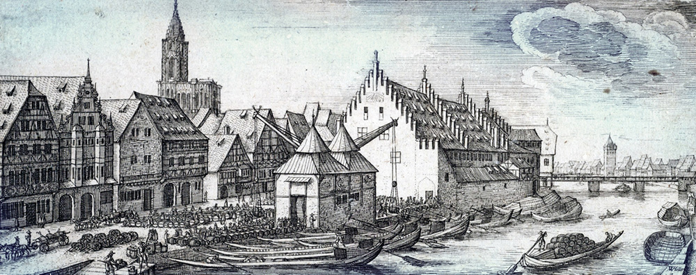
French sovereignty, German-speaking administration
This reflected the linguistic reality of Alsace.
Strasbourg had deep Germanic linguistic traditions. German was widely used in local administration, religion and printing, while Alsatian dialects were spoken in everyday life.
After 1681, the French crown did not immediately dismantle all the city’s existing institutions.
The old municipal system continued to function, and German remained important within it.
This explains why documents produced in eighteenth-century Strasbourg can still refer to Straßburg, even though the city had already been under French sovereignty for decades.
The same was true of street names.
When Strasbourg’s municipal authorities began having street names inscribed on buildings in 1773, and again in 1786, they were still written in German. See the surviving evidence for Strasbourg’s eighteenth-century street signs
Louis XIV tried to impose French — but change was slow
The monarchy did attempt to strengthen the use of French.
In 1685, royal authorities ordered that many official acts, legal documents and administrative procedures in Alsace should be written in French.
In practice, change was far from immediate.
German continued to be used extensively within Strasbourg’s local institutions.
Political power had changed quickly.
Language did not.
Why 1790 matters more than 1681
The more decisive break came with the French Revolution.
From 1789 to 1790, the old municipal structures were replaced by new institutions based on the revolutionary administrative system.
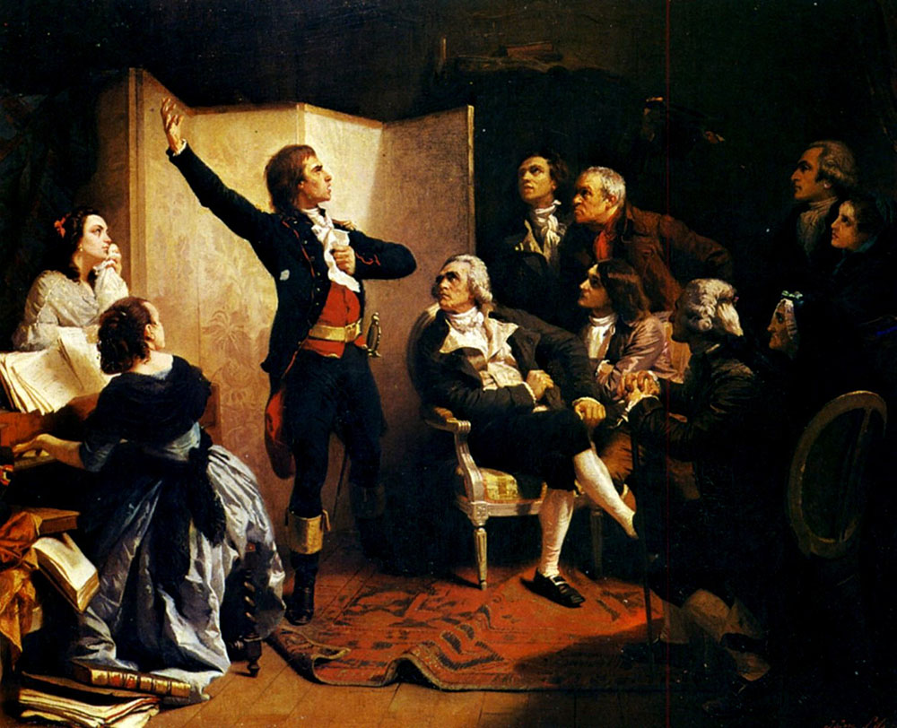
French became increasingly important in municipal records, although bilingual practices did not disappear overnight. The revolutionary authorities themselves still recognised the practical need to translate legislation into the languages used by local populations.
The sequence is therefore more complex than it first appears:
1681: Strasbourg becomes part of France.
During the following century: much of its local administration remains German-speaking.
Around 1790: French becomes much more firmly established in municipal administration.
So it would be misleading to say that Strasbourg was simply “renamed” from Straßburg to Strasbourg in 1681.
For more than a century, the two forms could coexist within different linguistic and administrative contexts.
Mulhouse offers an even more striking example.
Mulhausen to Mulhouse: When a Name Lags Behind the Border
Until the end of the eighteenth century, Mulhouse was not part of France.
It was the Republic of Mulhausen, an independent city-state closely allied with the Swiss Confederation.
That changed in 1798, when Mulhausen formally joined France.
But its name did not immediately become Mulhouse.
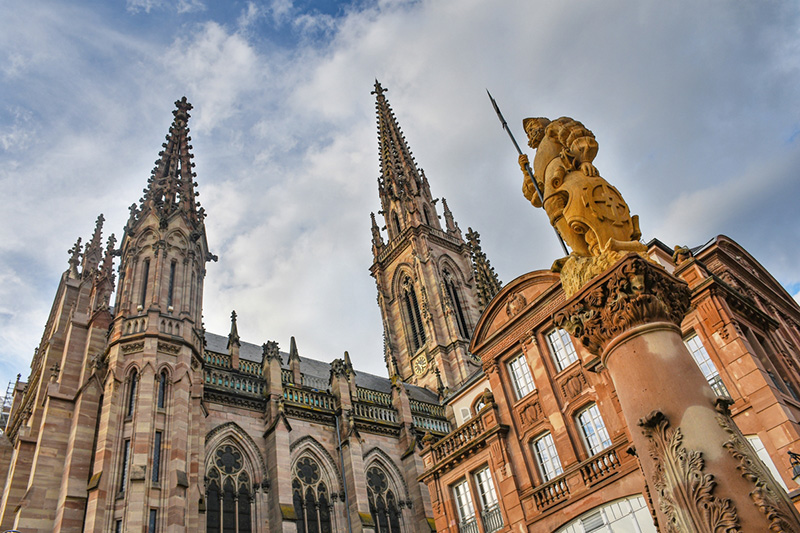
Mulhausen joins France in 1798
The treaty bringing the town into France still referred repeatedly to the “République de Mulhausen” and to the town as Mulhausen.
The treaty was signed on 29 January 1798 and formally incorporated the former republic into France. Read the 1798 Treaty of Reunion
So France governed a town whose official name remained visibly Germanic.
That situation continued for decades.
Even when King Charles X visited the town in 1828, it was still known officially as Mulhausen. Historian Marie-Claire Vitoux specifically notes that the town retained its Germanic name until 1848.
Why did Mulhausen become Mulhouse only in 1848?
The official change came only in 1848, under the Second Republic.
Heritage material produced by the City of Mulhouse confirms that the town was still called Mülhausen until that year. See the City of Mulhouse’s historical material
There was therefore a gap of around fifty years between the political change and the toponymic one:
1798: Mulhausen joins France.
1848: Mulhausen officially becomes Mulhouse.
The town did not become geographically or politically French in 1848. It had already belonged to France for half a century.
What changed was how the state chose to write its name.
Borders can change in a day. Place names may take decades to follow.
And elsewhere in Alsace, matters were complicated further by a linguistic frontier running through the region itself.
The Language Border Inside Alsace
It is tempting to imagine nineteenth-century Alsace as a clearly German-speaking region separated from French-speaking France by a neat linguistic line.
The reality was much more complicated.
For centuries, Alsace contained both Germanic-speaking and Romance-speaking communities.
Most of the plain and many of the main towns belonged to the Alemannic and Franconian linguistic world, while Romance dialects survived along parts of the western edge of the region.
These included the upper Bruche valley, several Vosges valleys and communities in the western and southern Sundgau.
The linguistic border did not perfectly match a political border. It crossed valleys and sometimes passed between neighbouring villages.
The BNU’s survey of Alsace’s linguistic history shows just how persistent this coexistence of French, German, dialect and Romance varieties was. Explore the linguistic history of Alsace
That matters enormously when we look at their names.
A French-looking name did not necessarily mean somebody had recently translated a German one.
Nor did a German-looking name automatically prove that a German government had invented it.
Lucelle or Lützel?
At the extreme southern tip of Alsace, close to the Swiss border, Lucelle provides a fascinating example.

The French name Lucelle and the German Lützel both have a long history.
Neither was invented after the Franco-Prussian War.
By the nineteenth century, Lucelle stood around the linguistic frontier, with French and German traditions meeting in this corner of the Jura.
When Alsace became part of the German Empire after 1871, Lützel became the official German form.
But describing that simply as a nationalist renaming would be misleading.
The German authorities had not invented Lützel. They were making an old German name official.
Bréchaumont or Brückensweiler?
A little further north, Bréchaumont tells a slightly different story.
Older recorded forms reveal strong Germanic roots, and Brückensweiler had a historical basis long before the nineteenth-century annexation.
Bréchaumont lay close to the linguistic frontier, where linguistic habits had evolved over generations.
Once again, Bréchaumont → Brückensweiler should not be treated as the invention of a completely new name.
Valdieu or Gottestal?
Valdieu brings us closer to the complexities that would later become politically sensitive.

Together with neighbouring Lutran, it belonged to a small group of Romance-speaking communities near Dannemarie that found themselves inside the German Empire after 1871.
Under German administration, Valdieu appeared as Gottesthal, later Gottestal, while Lutran became Luttern.
The German form of Valdieu was not simply invented in 1871.
But the case demonstrates an important principle:
the language chosen by an administration does not necessarily tell us what language the local population speaks.
That distinction became crucial after the Franco-Prussian War.
1871: When the German Empire Took Over the Map
Following France’s defeat in the Franco-Prussian War, the Treaty of Frankfurt transferred most of Alsace and part of Lorraine to the newly created German Empire.
The territory became the Reichsland Elsaß-Lothringen.
The political border had moved again.
And this time, the language of government moved with it.
German became the language of the imperial administration, and German forms of many Alsatian place names appeared on official documents and maps.
Strasbourg became Straßburg, Mulhouse Mülhausen, Haguenau Hagenau, Wissembourg Weißenburg, Saverne Zabern and Sélestat Schlettstadt.
But we need to be careful with the word became.
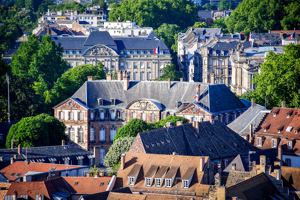
Strasbourg became Straßburg — but was it really renamed?
If we looked only at a French map from 1865 and a German one from 1875, we might conclude that Germany had renamed Strasbourg after the annexation.
Historically, that would be misleading.
As we have already seen, Straßburg had been used for centuries.
What changed after 1871 was its official status.
Before the annexation, Strasbourg was the form used by the French state while Straßburg remained common in German-language writing.
Afterwards, the German imperial administration made Straßburg official.
Historical German names returned to official use
The same principle applies elsewhere.
Hagenau was not invented as a replacement for Haguenau.
Weißenburg was not created in 1871 to replace Wissembourg.
Zabern had long existed alongside Saverne.
And Schlettstadt belonged to a complicated family of historical spellings for the town we now call Sélestat.
Mulhouse is particularly revealing because the process reversed what France had done only a few decades earlier.
The town officially became Mulhouse in 1848.
Under German rule, it returned to Mülhausen.
The town itself had not changed.
The government had.

Not every French name disappeared in 1871
If the German Empire had immediately set out to remove every visibly French place name, the story would be simple.
But it did not.
More than forty years after the annexation, communities in Romance-speaking parts of Alsace still carried official names such as Bellefosse, Belmont, Bourg-Bruche, Fouday, Grandfontaine and Saint-Blaise-la-Roche.
They existed on the map of the German Empire with names that looked unmistakably French.
For decades, this was tolerated.
Then came the First World War.
France and Germany were again enemies, Alsace-Lorraine lay close to the front, and questions of linguistic and national loyalty became much more sensitive. Modern historical research has shown how wartime German authorities increasingly regarded Alsace-Lorraine’s layered identities as a problem for national unity. For more information, read the Oxford Academic study of wartime nationalism in Alsace-Lorraine
1915: When Germanisation Became Deliberate
By 1915, Alsace-Lorraine had belonged to the German Empire for more than forty years.
Yet several villages still carried visibly French names.
The First World War changed how the authorities viewed them.
The imperial decree of 2 September 1915
On 2 September 1915, an imperial decree introduced new German forms for a series of French-named communes in Alsace-Lorraine.
One of our best sources is a booklet published in 1917, Neue Ortsnamen in Elsaß-Lothringen, preserved by the Württembergische Landesbibliothek. It contains an alphabetical list of the old names, the new names and the text of the imperial ordinance itself. For more information, consult the 1915 place-name source via LEO-BW
The timing matters.
Germany and France were at war, and questions of identity and loyalty within the Reichsland had become politically sensitive.
A French-looking name on a German map was no longer necessarily regarded as an innocent linguistic survival.
This was fundamentally different from simply using Straßburg rather than Strasbourg.
Why were Alsatian place names Germanised in 1915?
The simplest answer is that war made language more political.
Before 1914, the German Empire had tolerated a degree of linguistic complexity in Alsace-Lorraine.
During a war against France, that became harder for nationalists to accept.
The authorities did not invent every new name from scratch. Some changes translated an existing name, revived an older German form or adapted local historical material.
But the broader objective was to make the official map look more unmistakably German.
The Romance-speaking valleys stood out
The policy was particularly visible in places where Romance speech had survived.
One of the clearest examples was the upper Bruche valley, west of Strasbourg.
Parts of this mountainous area belonged to the wider Romance-speaking Welche linguistic world of the Vosges.
Their local names reflected that history.
Villages such as Bellefosse, Bourg-Bruche, Fouday, Grandfontaine and Saint-Blaise-la-Roche therefore stood out on a wartime German map.
From Bellefosse to Schöngrund
Among the changes introduced were:
| Name before 1915 | Germanised name |
|---|---|
| Bellefosse | Schöngrund |
| Belmont | Schönenberg im Breuschtal |
| Bourg-Bruche | Burg-Breusch |
| Fouday | Breusch-Urbach |
| Grandfontaine | Michelbrunn |
| Saint-Blaise-la-Roche | Heiligblasien |
| Saulxures | Salzern |
The methods varied.
What makes 1915 distinctive is not that every German name was newly invented.
It is that the state had decided the surviving French names themselves had become politically undesirable.
Bourg-Bruche and Burg-Breusch: a name caught between regimes
Bourg-Bruche remained officially Bourg-Bruche for more than four decades after the German annexation.
Then, in 1915, it became Burg-Breusch.
After the First World War, Bourg-Bruche returned.
Under German administration again during the Second World War, Burg-Breusch was restored.
After the Liberation, Bourg-Bruche returned once more.
Its twentieth-century sequence therefore reads:
Bourg-Bruche → Burg-Breusch → Bourg-Bruche → Burg-Breusch → Bourg-Bruche
The sequence tells us far more than a simple translation ever could.
Here the official name closely followed the political regime controlling the territory.
1918: France Changes the Map Again
When Alsace returned to France after the First World War, French administrative forms returned and many wartime changes were reversed.
But France did not simply translate every German-looking name.
The return of French administrative names
Strasbourg, Mulhouse, Haguenau, Wissembourg and Saverne returned to official French use.
Villages Germanised during the war also recovered earlier forms.
So Burg-Breusch became Bourg-Bruche, Schöngrund returned to Bellefosse, and Heiligblasien became Saint-Blaise-la-Roche.

Why did German-looking place names survive?
A modern map provides the answer.
Kaysersberg, Riquewihr, Eguisheim, Mittelbergheim, Bergheim, Turckheim, Molsheim and Schiltigheim all kept names with obvious Germanic roots.
French sovereignty did not require every Alsatian place name to look French.
The region’s geography still carried centuries of Germanic linguistic history.
How Schlettstadt became Sélestat
Sélestat shows how official naming can also involve standardisation.
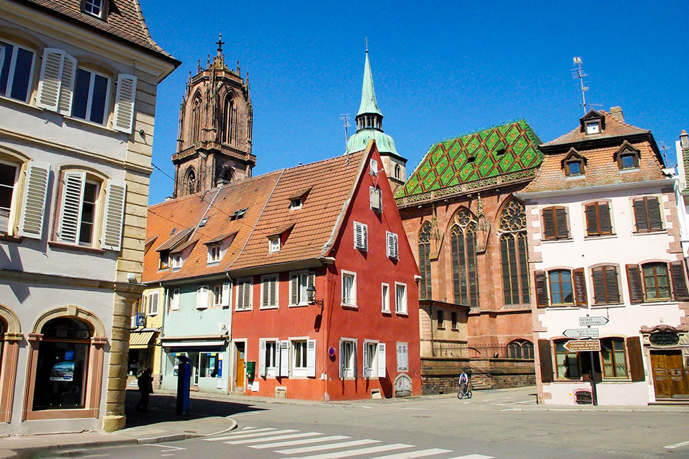
The town had appeared under numerous spellings over the centuries.
Under the German Empire, Schlettstadt was official.
After the return to France, the question of its spelling was settled in 1920. The Sélestat municipal council adopted the form Sélestat on 9 January 1920. For more information, see the Sélestat municipal historical source
Not every official alteration therefore belongs to the same political category.
Sometimes a state is also trying to establish a consistent administrative form.
The situation changed dramatically again in 1940.
1940: The Nazi Attempt to Erase French Alsace
After France’s defeat in June 1940, Alsace was placed under German civil administration and incorporated de factointo the Nazi system, although there was no formal annexation treaty.
The Mémorial Alsace-Moselle describes the policy that followed as one of de-Frenchification, Germanisation and Nazification of both population and territory. For more information, read the Mémorial Alsace-Moselle overview
Robert Wagner, Gauleiter of neighbouring Baden, was given responsibility for bringing Alsace into the Nazi German order.
The objective went far beyond changing the language of administration.
What was Entwelschung?
The authorities used the term Entwelschung for a policy of removing French influence from Alsace.
On 16 August 1940, Wagner ordered the Germanisation of place names and street names, together with measures affecting shop signs, surnames and first names.
Historian Alphonse Irjud’s study for the Société française d’onomastique documents the order and the wider campaign in detail. For more information, read the academic study on the Germanisation of names in Alsace, 1940–1944
The reasoning was explicit: continued use of French names might preserve the population’s attachment to France.
The regime wanted Alsace to acquire an unmistakably German appearance.
Germanising towns, streets — and even people
The campaign therefore reached far beyond maps.
French street names disappeared. Businesses were expected to use German. Personal names could also be Germanised.
Language had become part of a wider attempt to reshape identity.
Strasbourg’s streets became political statements
Strasbourg provides one of the clearest examples.
On 21 August 1940, three prominent squares were renamed:
| French name | Nazi-era name |
|---|---|
| Place Broglie | Adolf-Hitler-Platz |
| Place de la République | Bismarckplatz |
| Place Kléber | Karl-Roos-Platz |
Adolf-Hitler-Platz was not the German translation of Place Broglie.
It was a political statement placed at the heart of the city.
The renaming programme then spread across Strasbourg. By 1941, 3,434 metal street signs had been replaced. This process is documented in a historical research project on the Nazi-era administrations of Baden and Württemberg. For more information, read the study of Strasbourg’s Nazi street-name changes
The map was being rewritten not simply in another language, but in the political vocabulary of the regime.
Valdieu and Lutran under Nazi administration
The small Sundgau villages of Valdieu and Lutran demonstrate another side of the same process.
Both had historical German forms.
On 2 August 1940:
Valdieu → Gottestal
Lutran → Luttern
At first, the two remained separate communes.
Then, on 1 October 1941, Luttern was incorporated into Gottestal.
A detailed administrative chronology records both the August 1940 name changes and the October 1941 incorporation. For more information, consult the administrative chronology for the canton of Dannemarie/Dammerkirch
After the Liberation, the French communes of Valdieu and Lutran were restored separately.
They remained independent until 1973, when France merged them into today’s Valdieu-Lutran. The Haut-Rhin departmental archives confirm the 1973 merger. For more informations, see the Haut-Rhin archives record for Valdieu
Gottestal was not an invented Nazi name.
That is precisely why the case is so revealing.
An old historical name can still be revived for a new political purpose.
Governments Can Rename Places Faster Than People Can
An official name can change almost overnight.
A decree is signed. Maps are updated. New signs appear.
People do not necessarily change their vocabulary at the same speed.
A government controls official documents.
It does not completely control memory.
The official map and the map in people’s minds
In Alsace, a town could have one official name in French administration, another form in German writing and another pronunciation in local dialect.
When sovereignty changed, official terminology could change quickly.
Everyday speech was slower.
A German-speaking Alsatian living under French rule could continue to say Straßburg. A French speaker under German rule could continue to say Strasbourg. Dialect forms might survive regardless of which state controlled the region.
There are therefore, in a sense, two maps.
The official map produced by governments.
And the map people carry in their heads.
Hartmannswillerkopf or Vieil Armand?
The mountain known as Hartmannswillerkopf provides a particularly good example because its alternative French name did not originate in an administrative decree.
The summit became one of the most fiercely contested positions on the Vosges front during the First World War.
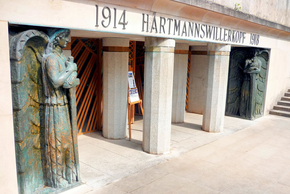
During the war, the French press began referring to the Hartmannswillerkopf as Vieil Armand.
The official Franco-German memorial site still explains that Vieil Armand was a name given to the mountain by the French press during the conflict. For more information, visit the official Hartmannswillerkopf memorial website
The alternative name was not imposed by an administrative decree.
It emerged during the war and survived in French usage.
Today, both Hartmannswillerkopf and Vieil Armand remain familiar names for the same mountain.
A government was not required to create the alternative.
People and public usage did it themselves.
Four Different Ways a Place Name Can Change
Understanding these differences is essential when asking why governments change place names. The history of Alsace allows us to distinguish several processes that can otherwise look identical on a map.
| Type of change | Alsatian example | What is happening |
|---|---|---|
| Two historical names in different languages | Strasbourg / Straßburg | Both forms existed independently of the modern political border |
| Change of official administrative form | Mulhouse / Mülhausen | A change of government makes another existing form official |
| Deliberate nationalisation of the map | Bellefosse → Schöngrund | A surviving French name becomes politically undesirable |
| Ideological renaming | Place Broglie → Adolf-Hitler-Platz | The replacement name explicitly promotes a regime |
| Revival of an old name for political purposes | Valdieu → Gottestal in 1940 | A historical form is reused within a programme of Germanisation |
This distinction is essential.
A different name on a map does not, by itself, tell us why the name changed.
We first need to know whether the new form was translated, inherited, revived, standardised or deliberately imposed.
So Who Owns a Place Name?
The history of Alsace suggests there is no simple answer.
A government has considerable power over official names. It decides what appears on administrative documents, road signs, railway stations and state maps.
But that does not mean it has complete ownership of the name itself.
Local residents may continue using an older form. Another language community may have its own historical version. Historians may preserve names that disappeared from official use centuries ago. Neighbouring countries and international mapmakers may make different choices.
A place name can therefore belong to several worlds at once.
Governments control official maps
States have the clearest authority over their own administrative systems.
France can decide that its official name is Strasbourg.
Germany once used Straßburg.
The United States can decide what terminology its federal agencies use for a geographical feature.
Official names matter because they shape maps, signs, schools, transport systems and public documents.
But official recognition is not universal acceptance.
Local communities carry their own geography
People often preserve names through dialect, memory and habit.
In Alsace, centuries of political change never completely erased the region’s layered linguistic geography.
That is why asking which of two historical names is the “real” one can sometimes be the wrong question.
Both may be real.
They simply belong to different languages and histories.
A government can name a place without owning its memory
Before judging any change, we therefore need to ask:
Was the name already used historically?
Was it simply the form used in another language?
Was an old name being restored?
Was a spelling being standardised?
Or was the aim to replace an unwanted identity with a new one?
Perhaps the clearest conclusion is this:
A government can decide what its own maps say. It cannot necessarily decide what everyone else calls the place.
And that brings us back to the question that started this article.
From Lake Ontario to Lake America
In August 2026, the US federal government adopted Lake America as its official name for Lake Ontario.
The executive order requires US federal references to adopt the new terminology and the federal geographic-name database to be updated. Read Executive Order 14420
The lake is shared with Canada, which continues to use Lake Ontario.
So how does this compare with what happened in Alsace?
Only partly.
Why Lake America is not the same as Straßburg
The first distinction is straightforward.
Straßburg was not invented in 1871.
It was an old German form, used for centuries and already familiar to German-speaking Alsatians before the annexation.
When the German Empire made Straßburg official, it selected an existing historical linguistic form.
Lake America is different.
It is not simply another linguistic form of Lake Ontario. Nor is it an old local name revived after falling out of use.
It is a newly adopted official name chosen for its national symbolism.
| Straßburg | Lake America |
|---|---|
| Historical German form | Newly adopted political name |
| Used long before 1871 | Introduced in 2026 |
| Part of a multilingual naming tradition | Chosen for explicit national symbolism |
| Became official following a change of sovereignty | Adopted for US federal use without a change of sovereignty |
So comparing Lake America directly with Straßburg would tell us very little.
The more interesting parallel lies elsewhere.
What Lake America has in common with political renaming
The connection becomes clearer when we look at moments when governments deliberately wanted the map itself to send a message.
In 1915, German authorities targeted French names that had survived for decades inside the German Empire at a time when wartime nationalism had made questions of language and loyalty increasingly sensitive.
Under Nazi rule from 1940, that process became radically more coercive and extensive.
The historical circumstances are profoundly different.
A US presidential executive order in 2026 is not equivalent to the wartime Germanisation of Alsace, and certainly not to the policies of the Nazi regime.
But one symbolic mechanism is recognisable:
geographical naming can be used to make a statement about nation, identity and political power.
One lake, two official realities
Lake Ontario also reminds us of something familiar from Alsatian history.
Official naming systems can coexist.
The United States can instruct federal agencies to use Lake America.
Canada can continue to use Lake Ontario.
Other governments, publishers, mapmakers and ordinary people can make their own choices.
The result may therefore be several names occupying the same geographical space.
Generations of Alsatians would have understood that perfectly well.
Changing the map is easier than changing usage
Governments are very good at changing official terminology.
They can issue decrees, replace signs and update databases.
What they cannot guarantee is that everyone else will follow.
That is why the future of Lake America will not be determined by the executive order alone.
It will also depend on whether the new name enters widespread ordinary usage — or remains primarily a term used within the US federal system.
History shows that the two are not always the same.
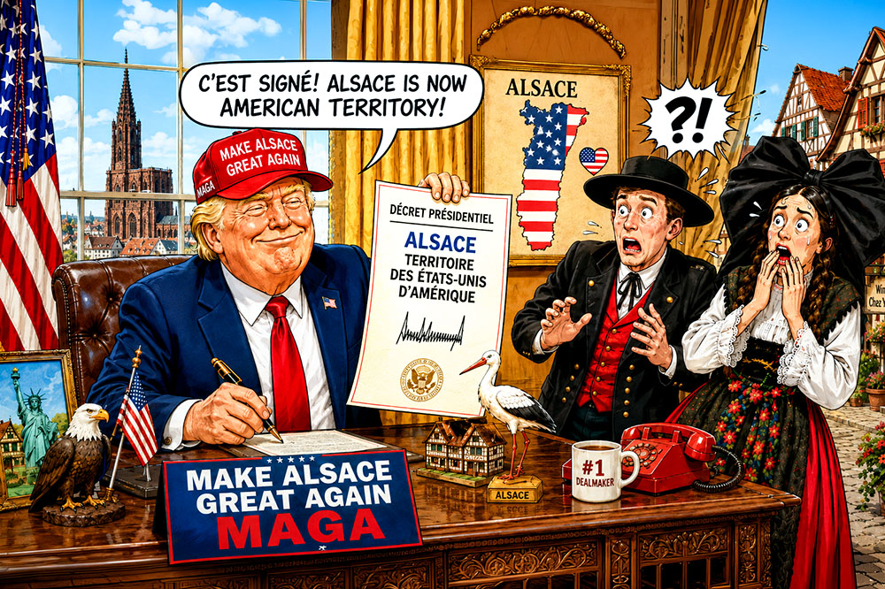
A Map Is Also a Story About Power
The history of Alsace helps explain why governments change place names — and why those changes can mean very different things.
Strasbourg remained beside the Rhine whether official documents called it Strasbourg or Straßburg.
Mulhouse stayed in the same place while its administrative name shifted between Mulhausen, Mulhouse and Mülhausen.
Bourg-Bruche did not move when it became Burg-Breusch.
Valdieu remained the same village when German authorities called it Gottestal.
The geography stayed where it was.
What changed was the authority describing it and, sometimes, the message that authority wanted the name to convey.
That is why we need to distinguish between historical names in different languages, administrative changes, deliberate nationalisation and explicitly ideological renaming.
They may all change what appears on a map.
They do not tell the same historical story.
A government can change an official name quickly.
But it cannot automatically change the language people speak, the names they remember or the history attached to a place.
Governments may control the map for a time. But place names also belong to the languages, communities and memories that continue to use them.